


Visa, MasterCard, Amex, Paypal or 3 times, interest-free with Scalapay

0.01€ from 35€ of purchase in France and from 99€ throughout Europe

Delivery in France and around the world at home, at office or in a pickup point

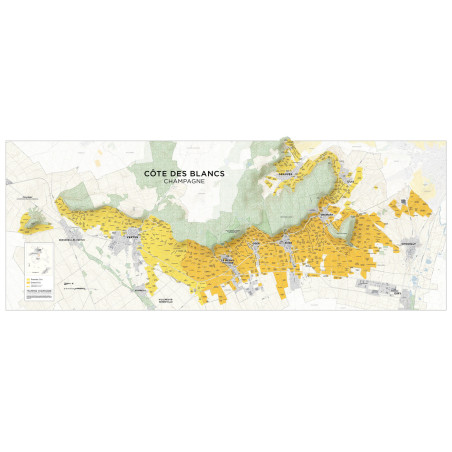
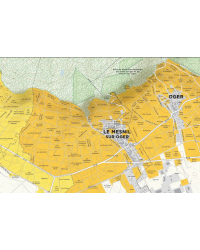
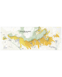
This large format map (nearly 1.5m wide) shows the main part, or cuesta, of the Côte des Blancs in Champagne.
The map can be accompanied by a 120-page bilingual field guide in French and English that allows you to visit the terroir of the village and its unique wines, a complete list of localities planted (or partially planted) in the commune, and a directory of its winegrowers.
The Côte des Blancs map is available as a high-quality print and is sold without a guide in the field (extra charge)
Dimensions: 59.0 x 23.625 inches, 150 x 60 cm
Impression: Lithograph on 100 matte coated paper (150 g/m2)
Published: October 16, 2022
ISBN Card: 978-0-9723632-9-7
Data sheet
You might also like

