


Visa, MasterCard, Amex, Paypal or 3 times, interest-free with Scalapay

0.01€ from 35€ of purchase in France*

Worldwide Shipping

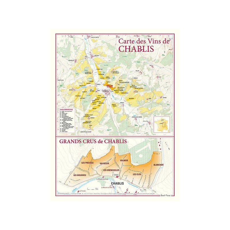
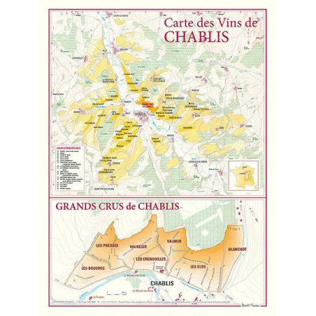
This cartographic document presents the Chablis vineyard as a whole at a scale of 6.6 centimeters per 1 kilometer.
It features in different colours the Grands Crus vineyard, the "Main" and "Component" Premiers Crus, the Chablis and Petit Chablis appellations. A table mentions in detail the list of Premiers Crus with identification grid. A second map represents in extreme detail, at a scale of 10 centimeters for 1 kilometer, the hillside of the 7 Grands Crus with their precise delimitation, the mention of paths and trails, contour lines, points altitude.
ED: Benoît France
Data sheet